



A gravel road narrows into a dense spruce forest at dusk
Enduro | Adventure | ATV

Routes the others never see.

Rospuutto is a route planner and navigator for enduro, adventure and ATV riders in Finland. It knows which forest roads you can ride and where the gates are, and it draws a route that avoids them. I built it because nobody else did.

Closed beta | autumn 2026 | iPhone first
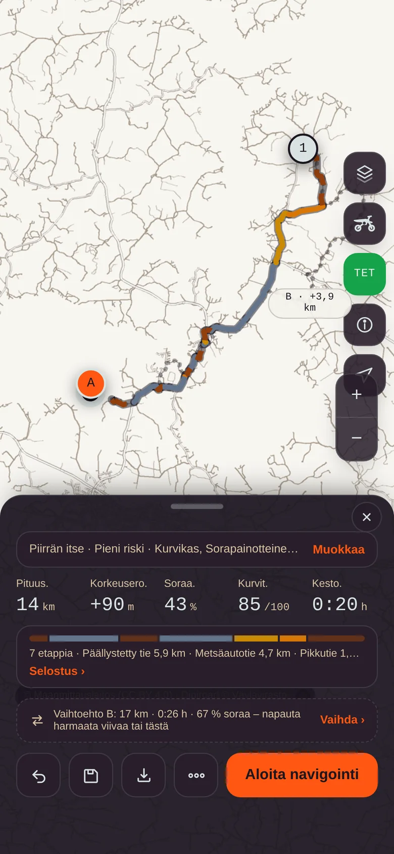
Route planning in Rospuutto: a 14 km route in Iitti with legs and alternative B

Rospuutto once stopped travellers. Now it shows the way.

3trust levels for every road
10 600 kmof TET Finland on the map
18cards for the ride view
800 mwarning before a gate
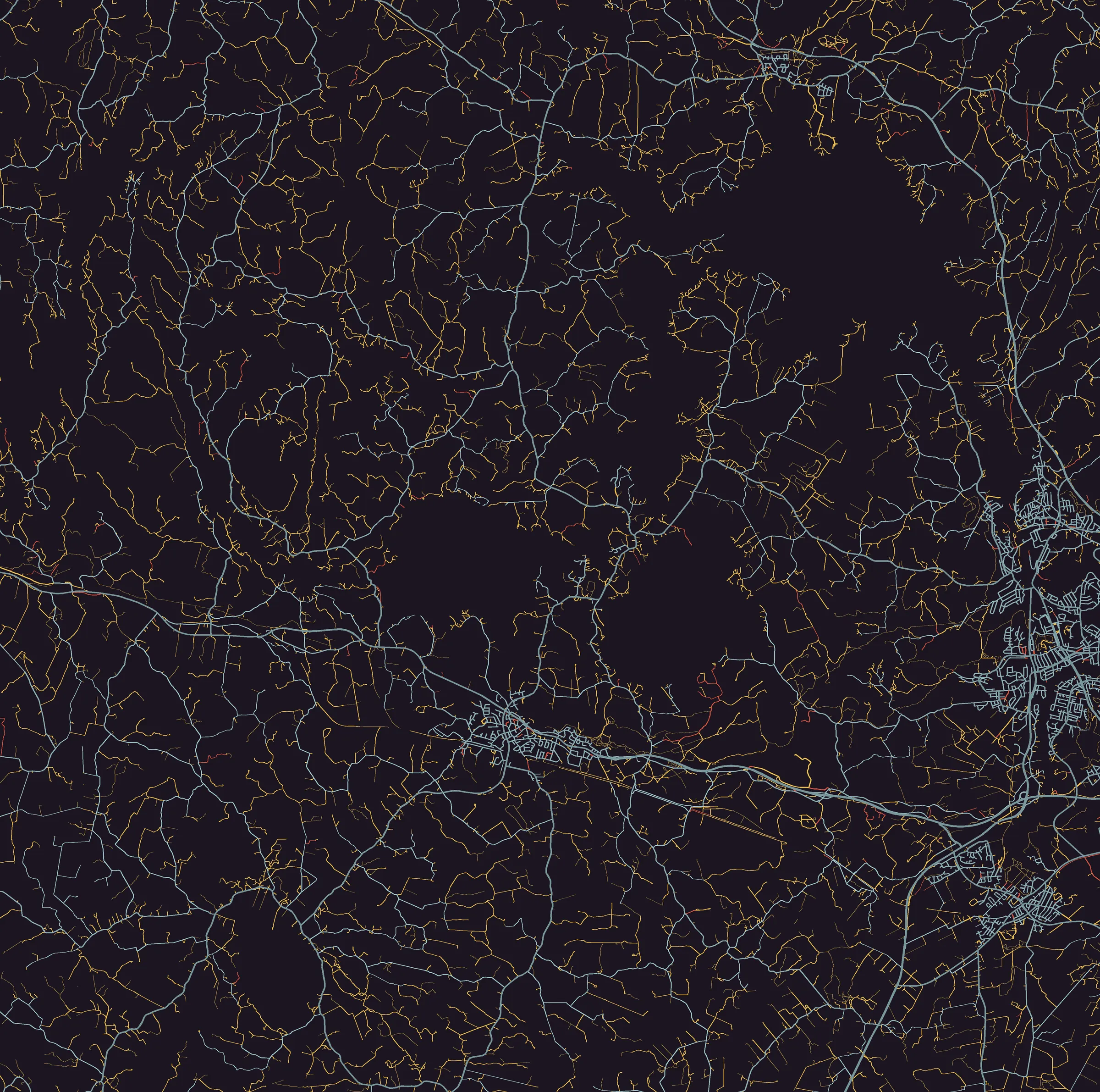
The road network around Iitti by trust level: open roads in blue, unknown in yellow, closed in red

Every stretch of road has a trust level.

In Finland a forest road can be open, closed with a gate, or anything in between, and an ordinary map will not tell you which. You usually find out at the gate, twenty kilometres from the nearest place to turn around. Rospuutto combines Digiroad, the National Land Survey and reports from riders, and colours every road by what is actually known about it. This is not an illustration but a real map of the Iitti region: 23,000 road segments.

Open

State, municipal and open roads

No barrier or restriction data. On the Safe level the route uses only these. Dull, but nobody comes out shouting.

Unknown

Private and forest roads

On the map, but nobody has confirmed that you can pass. A gate is possible. Finland is full of these, and these are where the best rides happen. Included only on the Low risk level, and the responsibility is yours.

Closed

Gate or ban on record

From the registry or from other riders. The route avoids these, and if you ride towards one anyway, the app warns you 800 metres ahead. After that it is between you and the gate.

SafeOpen roads only. The default for new users and for the first trip to an unfamiliar region. Also when your wife is on the back.
Low riskAlso private roads with no data. Detours are long, gravel is preferred. This is the level I ride on, and probably you too.
High riskAlso trails and poor forest roads. For enduro and ATV. A road bike never gets trails, however nicely it asks.
OpenUnknownClosedRoute

Tap the points. Rospuutto finds the road.

You draw the route with a finger on the sofa, the app calculates it along real roads and tells you before you leave what to expect: how much gravel, how many legs, where the trust level changes. Then you ride it guided by the same app. No cables, no dragging GPX files into any device. That was the whole point of this thing.

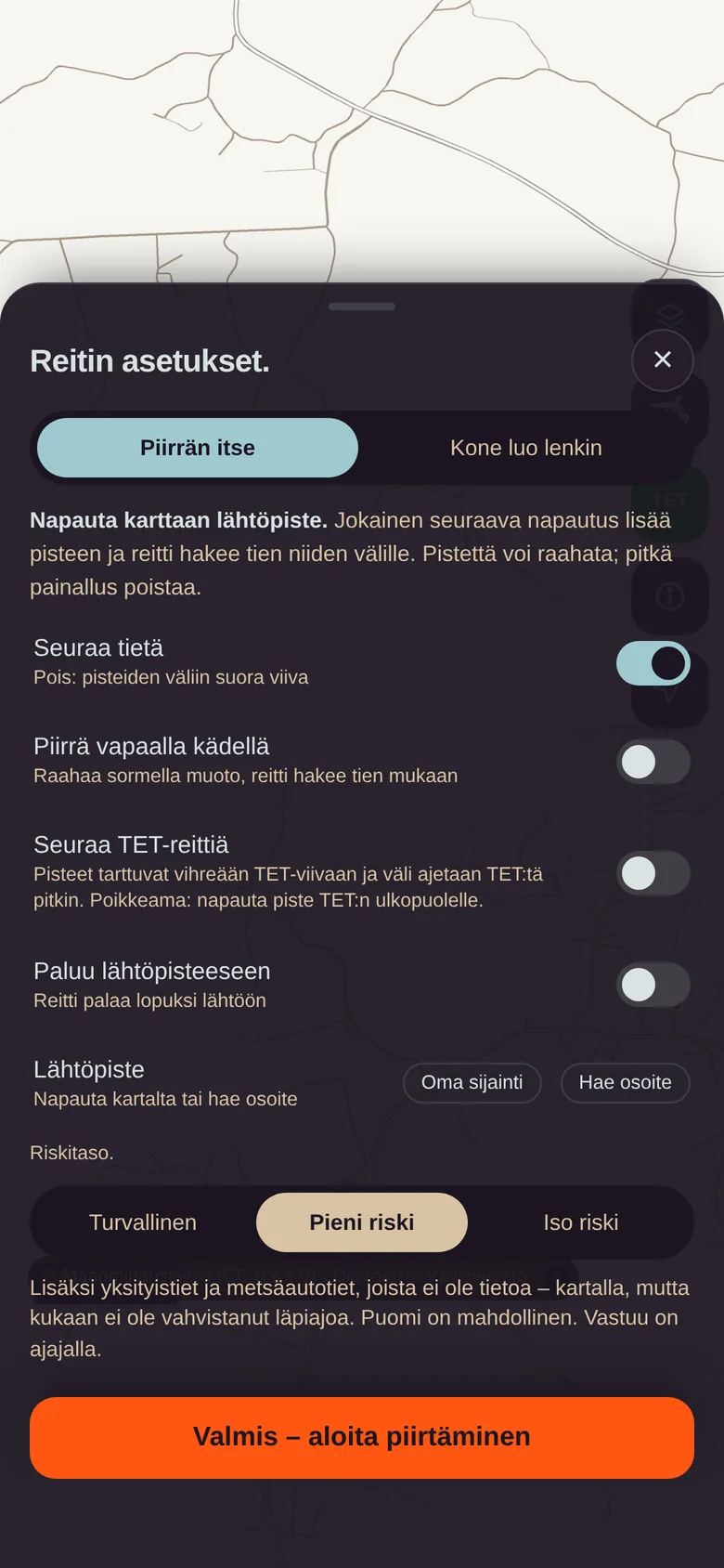
Route settings: draw it yourself or let the app create a loop, risk level, route character
Choose first, then draw.Risk level, vehicle and route character (twisty, gravel-heavy, fastest) are set before drawing. Everything can be changed mid-ride, once you come to your senses.
A drawn route in Iitti: 14 km, 43 % gravel, 7 legs and alternative B
Alternative B waits in grey.Between two points a second route is always calculated. Tap the grey line and it takes over. Usually B is the one that should have been A.
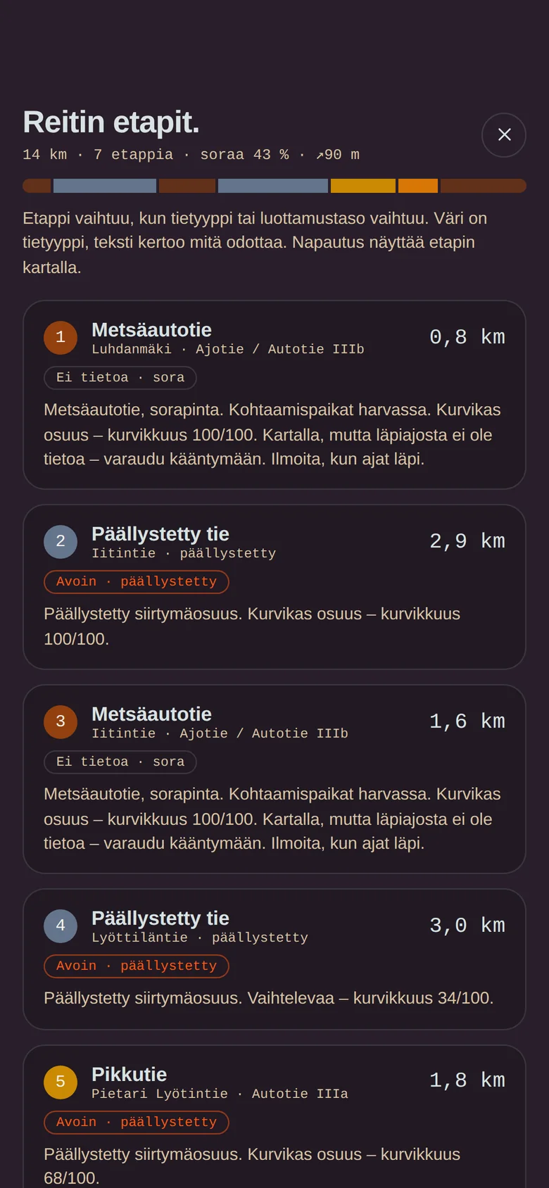
Route legs: road type, trust level and surface for every stretch
Legs tell you what to expect.Forest road 0.8 km, unknown, gravel. Paved transfer 2.9 km. Twistiness out of a hundred. A tap shows the leg on the map, in case you do not believe it.
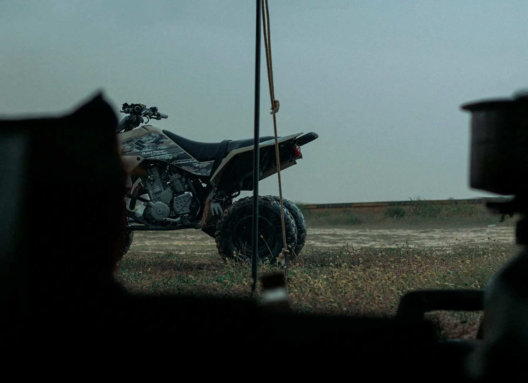
An ATV parked on a field at dusk

Same point, three different routes.

The vehicle says what the bike can physically and legally do. The risk level says how much uncertainty you accept. Two different things, even if I mix them up myself now and then. Rospuutto combines them every time it calculates a route.

  • Motorcycle. No trails, no sand, rocky forest roads only when needed. Asphalt is fine. An adventure bike is an adventure bike mostly in the adverts.
  • Enduro. Seeks out tracks: good gravel roads and asphalt get a mild penalty, poor forest roads rise.
  • ATV. Not on major roads, 60 km/h, vehicle-specific bans respected. The narrowest tracks only at half weight, because wide is wide.
Road classSafeLow riskHigh risk
Major road, pavedFor transfersFor transfersAvoided
Minor road, gravel roadYes, if openYesYes
Forest roadOpen onlyAlso unknownAlso poor ones
TrailNoNoEnduro and ATV
Closed (gate, ban)NoAvoidedAvoided, with warning

Name the distance. Go ride.

Some days you cannot be bothered to plan. Give a distance and a direction and Rospuutto generates a loop that starts and ends at the same point, usually the cottage yard. The length lands within ±20 % of what you asked, which is more than I can say for my own time estimates. If you do not like the loop, Reroll gives another one with the same settings.

  • Same risk level and vehicle as when drawing. The loop respects the same rules.
  • Start from your location or by tapping the map.
  • Save and ride again. The loop remembers its seed and is born the same. You do not have to remember anything.
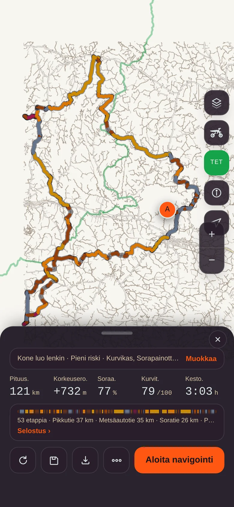
Generated loop: a 95 km loop around Iitti
95 km, 68 % gravel.The result is a real loop on real roads, not a line through the forest. Such apps exist.
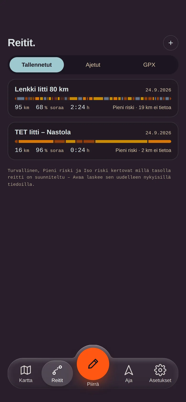
Route library: saved routes with leg bars
The library remembers everything.Saved routes, recorded rides and imported GPX tracks in one place. GPX export works without an account, should you for some reason want it in that unnamed device.
Two wheel tracks cross a heath coloured by the sunset

Trans Euro Trail, on your own terms.

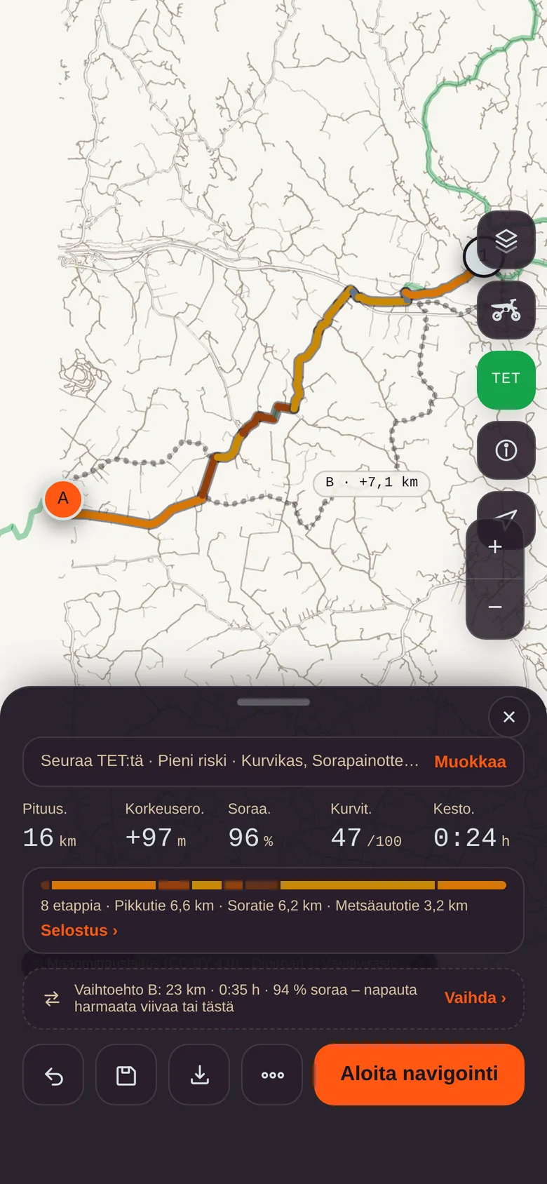
Trans Euro Trail is the route everyone says they ride, and the Finnish sections are better than most people admit. Switch TET on and a green line appears on the map. Tap points onto the line and the route follows TET between them. Tap a point off the line and the route detours there and comes back. That is how you combine TET sections and your own loops into one day, with a coffee stop in between.

  • The risk level applies on TET too. On the Safe level a closed road is avoided even if TET runs through it.
  • Return to start turns a TET section into a loop: back by a different road.
  • Back onto TET after a detour, no shortcut to the next point.

TET Finland © Trans Euro Trail CIC | Shown for personal use only.

Follow TET: the route runs along the green TET line for 16 km
A black-and-white forest road disappears between the pines

Cards you build yourself.

While riding you see only what you want: speed with the limit ring, distance with the surface bar, the next turn and the gate warning. There are 18 cards, and they are arranged like apps on a phone home screen. And yes, there is an XL size. Middle-aged eyes have been taken into account, because the maker has a pair.

  • Long press to edit. Drag, remove, add pages. Three sizes: Small, Medium, Large.
  • Glove mode. Big buttons, taps only. The screen stays on. The gloves stay on.
  • Voice guidance. Turns and distances in your earphones, no street names. Forest roads have names nobody can pronounce anyway.
  • The surface bar tells you how many kilometres of gravel are still ahead.
Next turn card: continue on Iitintie, 297 m
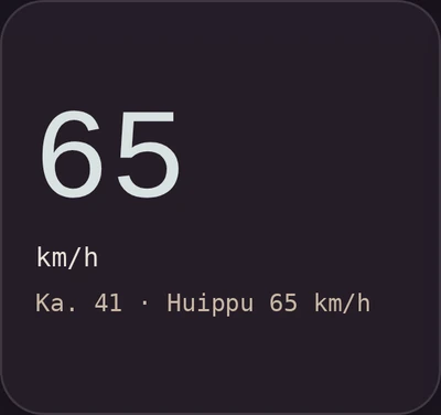
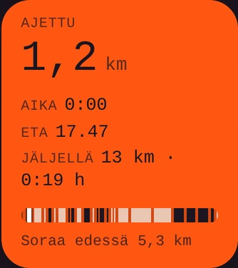
Speed card: 65 km/h, average and top speedTrip card: 1.2 km ridden, time, ETA, remaining and the surface bar
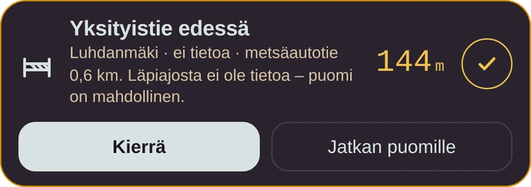
Small cards: heading 078° ENE, altitude 108 m, ascent +23 m Warning card: private road ahead in 144 m, Detour or Continue to the gate
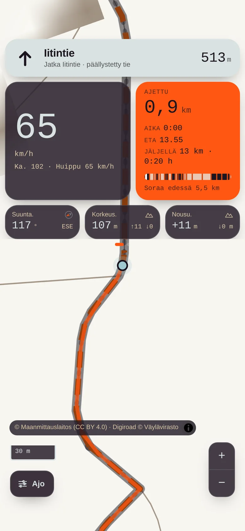
Navigation running: turn instruction, gate warning and cards over the map
Navigation.Turn at the top, cards in the middle, map below. When you ride past a junction (you will), a new route is calculated in 12 seconds with the same settings, and nobody says a word.
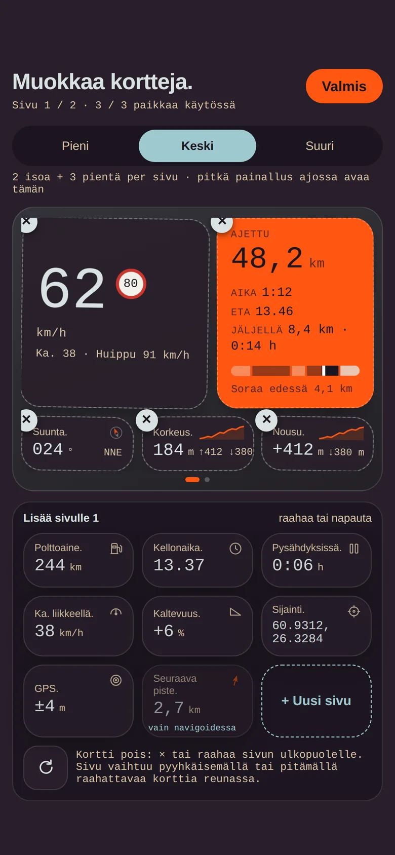
Card editor: draggable cards, three sizes and a card tray
Edit cards.Five pages you swipe while riding. A tray at the bottom to drag cards from. Just like an iPhone, but in the forest.
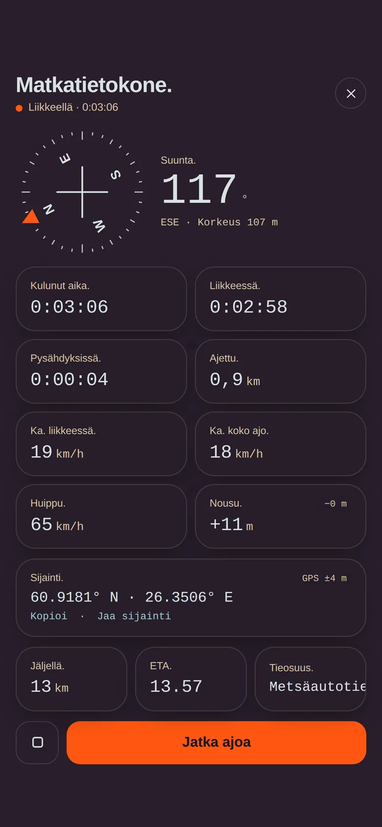
Trip computer: compass, times, speeds, position and ETA
Trip computer.Every figure on one screen when you stop: compass, times, speeds, coordinates to copy. Top speed is shown, so there is no need to exaggerate it in the evening.
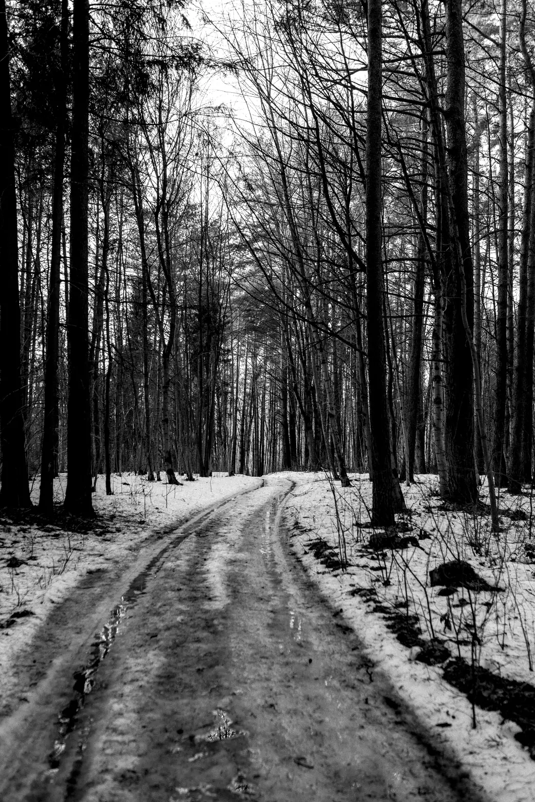
A snowy forest road in black and white

The warning comes 800 metres ahead.

When the road ahead is one nobody has confirmed you can pass, Rospuutto tells you in time: how long the stretch is, what is known about it, and two buttons. Detour calculates a new route on open roads only. Continue to the gate lets you go and look, and at the gate the app asks whether it was open. You answer honestly, because the next rider trusts you. That is the core of the whole thing: gate data is made by riding, not in an office.

  • Report a gate with two taps. The position comes from GPS, type and state from a list.
  • Mark a place. Lean-to, fire pit, petrol station, a good view. Visible to others on the map.
  • Reports expire in 12 months. Signs grow over, gates get removed, road associations change their minds. Old data does not linger.
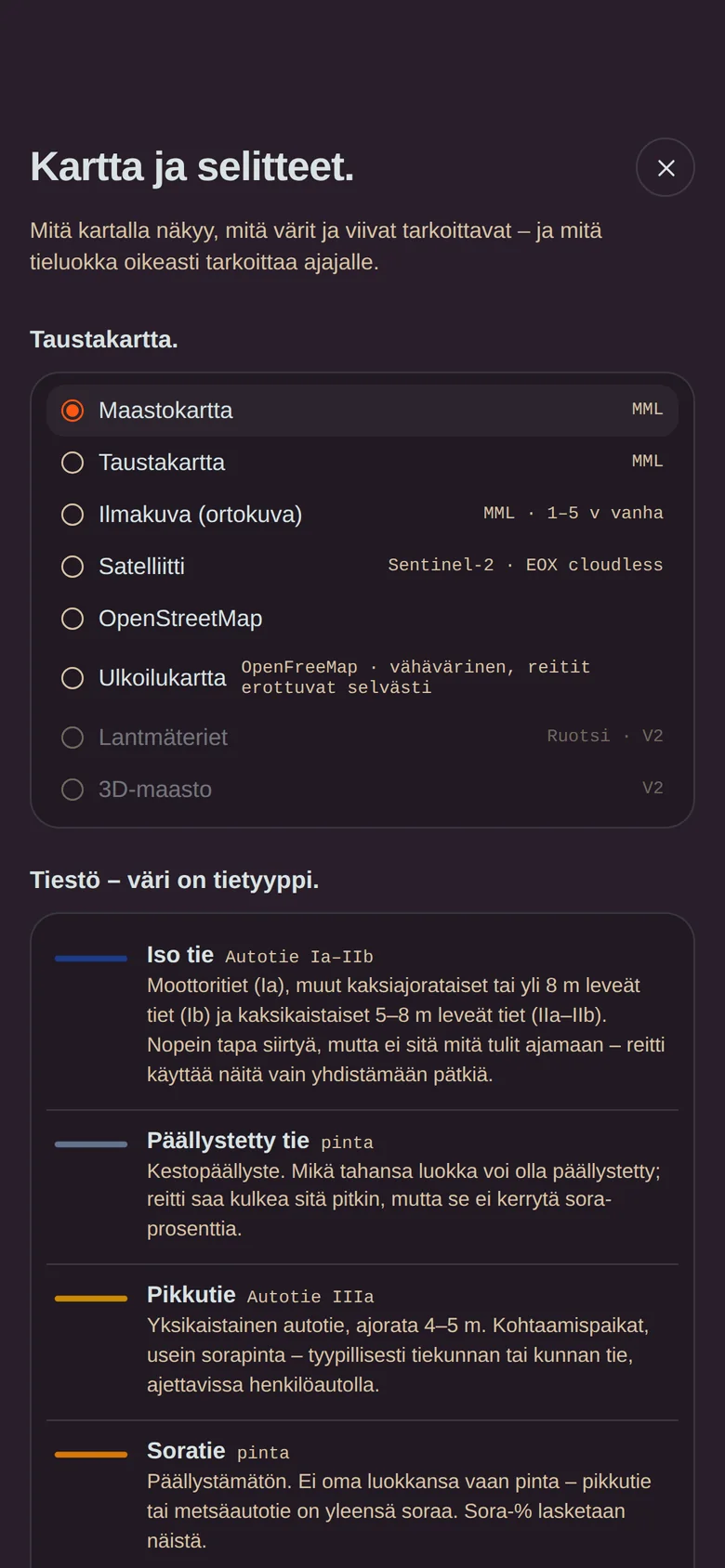
Map and legend: base maps and road type colours

Rospuutto is a tool for the responsible rider. It does not give you permission to ride a private road. It helps you know where permission is needed.

  • Riding a motor vehicle on a private road in Finland requires permission from the road association or the owner. The app says so on first launch and on every risk level, and I am saying it here once more.
  • Safe is the default. High risk is a deliberate choice that reminds you of your responsibility every time. A bit like the voice in your head, but written down.
  • Official no-entry signs are obstacles for routing on every level. Community reports steer you away from closed roads, never onto them.
  • Reports are stored at 10 m precision without a user account. Nobody sees who reported.
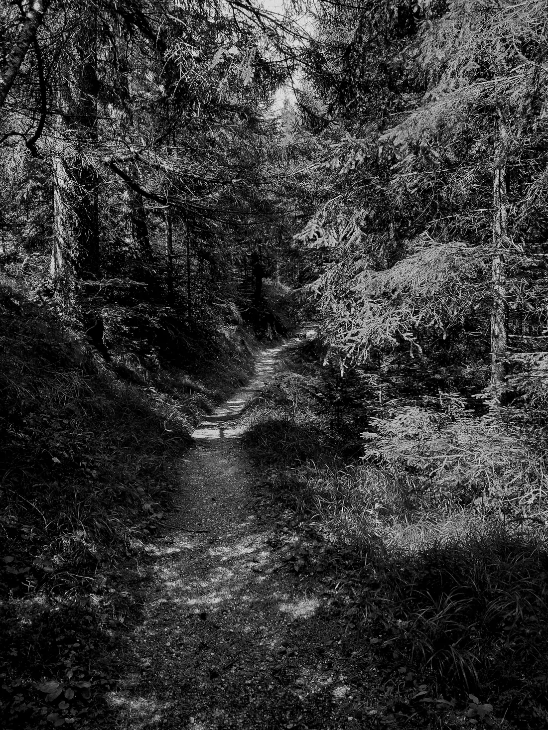
A mossy path disappears into a spruce forest

You decide what is said about your road.

I fully understand if you do not want a bunch of bikes on your road. That is why a road association account is coming, for marking your road in Rospuutto free of charge: no through traffic, through traffic allowed, or allowed for a fee. I verify the marking by hand (association decision, private road register extract or a photo of the sign), and strong authentication comes with accounts. Nobody gets to mark the neighbour's road for fun.

No through traffic

Road off the routes

The marking makes the road closed on every risk level. Riders do not end up at your gate, and nobody rides into your yard asking whether this goes through.

Allowed

Welcome

The road shows as open and trusted. Riders find it before the neighbour's, and most people would rather ride where they are welcome.

For a fee

Against payment

Finnish private road law allows a usage fee. Rospuutto can tell the rider how and to whom it is paid.

Want to be among the first road associations? Get in touch and we will tell you what information is needed.

Finnish open data, correctly combined.

Rospuutto does not guess. Every line on the map comes from public data, and the trust level is calculated with the same rule for every road. When the data updates, the map updates. Finland has absurdly good open data about its roads; nobody had just combined it for this purpose.

Roads from Digiroad

The Finnish Transport Infrastructure Agency's Digiroad gives every road segment its administrative class, surface, vehicle-specific bans and frost damage data. Private roads are identified from this.

Class and gates from the National Land Survey

The topographic database gives the road class (from main roads down to trails) and the gates. Together these decide whether a road is open, unknown or closed.

Routing on our own server

A GraphHopper router runs with our own rules: three risk profiles, vehicle-specific weights. Route points are not stored anywhere.

National Land SurveyTopographic database | CC BY 4.0

Base maps, aerial images, road classes, property boundaries.

DigiroadFTIA | CC BY 4.0

Road segments, bans, surfaces, private roads.

Trans Euro TrailTET Finland | own GPX

Shown on the map for personal use only, never shared.

CommunityRospuutto riders

Gates, obstacles and places. 12-month lifecycle.

Risto Vauras sitting in an armchair in his studio
Born from a need

Rospu-what?

A few years ago I realised that adventure riding is, without any doubt, the best fun a middle-aged man can have. Being stuck in the mud every now and then, what could be better. And digging yourself out, that is the real joy. Soon I will learn to wheelie, and then the front wheel will not wear at all.

Planning routes has been my hobby for a long time. The planning itself was never hard, but getting the track into a certain unnamed Garmin device has been genuinely painful.

Now that AI does everything for us anyway, I wanted to use it for something good: a Finnish app for planning a route on the sofa and then riding it guided by that same app, without five different programs and shuffling GPX files around. Since no such app existed, I started building it myself. Well, there were some, but none this good.

rospuuttoan old Finnish word for the mud season: the weeks in spring and autumn when the roads soften and nobody gets anywhere. Rospuutto once stopped travellers. Now it shows the way.
Risto VaurasIitti, Finland, autumn 2026
KTM 690 Enduro R, model year 2013, an AI-drawn product image
KTM 690 Enduro R2013 | Risto's

An extremely important feature.

If not one of the most important: Rospuutto lets you put a picture of your own bike in it. It affects neither routing, nor navigation, nor anything else. It is there because it is nice.

You take a photo of your bike, or if the bike is too dirty to photograph (the correct answer is always yes), you give the make, model, year and colour, and AI draws a product shot of the kind that could have been in the brochure, had you bought the more expensive one. On the left my own KTM 690 Enduro R from 2013, which in reality is somewhat muddier.

This is not that serious a business. The route has to be found and the gates have to be known, but in between you are allowed to enjoy yourself.

Try it with your own bike.

Checking whether the image service is awake…

Your photo goes nowhere, it is shown in this browser only. When creating an AI picture, the make, model, year and colour are sent to OpenAI. A few pictures per day.

Ride among the first.

For the autumn 2026 test I am looking for enduro, adventure and ATV riders with an iPhone and opinions. Tell me briefly what you ride and where in Finland. The test version is not a finished product, and that is exactly why I need you. There will be bugs, that much is promised.

Apply by email Read the tester guide ›